Overview · CNA Pro
Pro tool
Hunt Current Celltower
Pin down the true position of the tower you are connected to, to within tens of metres, using only the timing your phone already exchanges with the network.
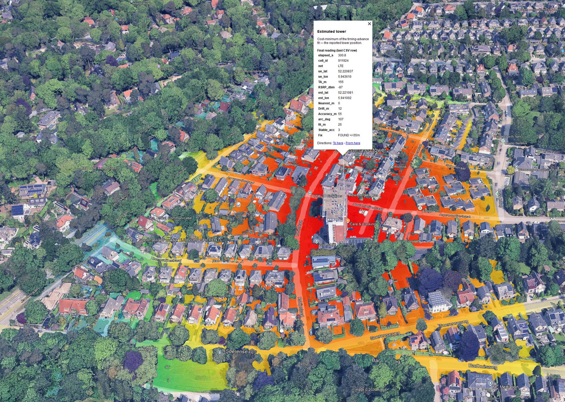
Pin down the true position of the tower you are connected to, to within tens of metres, using only the timing your phone already exchanges with the network.
When CNA shows you a tower's location, it looks it up from the largest tower-location database in the world. That is a great starting point, but those public locations are still estimates, and they are often hundreds of metres off from where the antenna actually stands.
A hunt does something different: it measures the real position from your own phone's timing, on the spot. And here is the nice part: if we all hunt the towers around us and share the results, the shared database gets steadily more accurate, so everyone's lookups improve. A little effort from many people adds up to far better tower locations for the whole community.
Every phone constantly measures its timing advance (TA). Here is why the network needs it. A radio signal takes time to travel, and on a connection it travels twice: the tower's downlink reaches a distant phone slightly later than a near one, and the phone's uplink reply then takes just as long to travel back. The tower measures this full down-and-up round trip for each phone and sends back a timing advance, an instruction to "transmit this much earlier". A distant phone gets a larger TA, a near phone a smaller one, so that once both the downlink and the uplink travel time are accounted for, every phone's uplink still arrives neatly aligned at the tower, and they do not collide.
Because the timing advance encodes that round-trip travel time, it is a direct measure of your distance to the tower, and that is exactly what CNA turns into a range.
Since TA is distance (on LTE, roughly 78 m per step), a single reading tells you the tower lies somewhere on a ring at that distance around you. Move a little and you get a new ring from a new place. Gather enough rings from enough angles and they intersect at one point: the tower.
CNA does exactly this as you walk or drive: it collects fresh TA readings, fits them to a cost surface, and narrows an estimate until it settles. To get a fresh reading it briefly lets the radio go idle and nudges it, forcing a new timing acquisition every few seconds.
The panel above the map is your convergence dashboard. Each value turns green once it meets its target. Here is what each one means, and how you make it better.
| Parameter | What it tells you | How to improve it |
|---|---|---|
| TA ~m | Your current distance to the tower from timing advance. | Falls as you get closer, your best "warmer / colder" signal. |
| Readings n/8 | How many usable TA readings you have gathered (about 8 to start). | Keep moving; each fresh acquisition adds one. |
| Nearest m | The closest you have actually passed to the estimate. | Walk past the tower; a close pass (near 0 m) anchors the fix. |
| arc ° | The largest angular gap you have not yet observed around the tower (360° means seen from one side only). | Circle the tower, so the rings cross from many angles. |
| fit m | How consistently the rings agree with the estimate (fit error). | Prefer line-of-sight; obstructions and reflections (NLOS) stretch TA and raise the fit. |
| Drift m | How much the estimate still jumps between readings. | Falls automatically as the arc closes and readings pile up. |
| Accuracy m | The current ± accuracy of the estimate. | Improves with a smaller arc and a closer pass. |
| Stable acc n/3 | Consecutive readings where the accuracy held steady. | Reaching 3/3 latches the fix. |
| Fix | The overall state and current ± (see the three states below). | Progresses from search, to SETTLED, to FOUND. |
The Fix line always shows a current ± accuracy, plus one of three states. They mark how far the hunt has progressed.
An estimate already exists and always carries a ± accuracy, but not all criteria are met yet. CNA keeps narrowing as you gather more geometry.
All the criteria are green: enough readings, a close pass, and a stable, tight fix. The result is now stable, storable and shareable, even before the accuracy stops improving.
The accuracy has also plateaued (stopped improving): the best fix achievable at this spot. FOUND always implies SETTLED.
search → SETTLED → FOUND
The state can also be released back to searching if the fix later degrades, jumps, or the serving cell is lost.
The interesting part of a hunt is not the start or the end, it is the middle, where the readings target is already met but the fix is still loose, and it is up to you to work the other criteria. Here is that story, frame by frame.
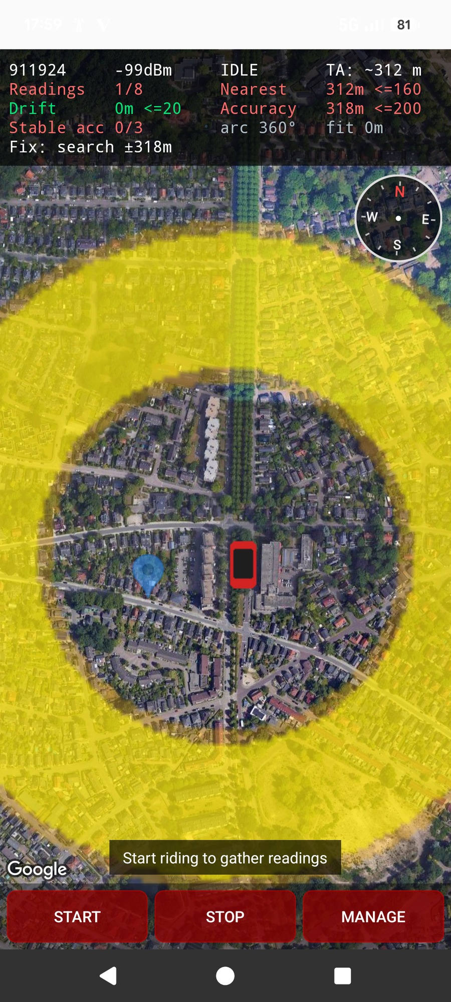
At the first reading CNA knows only that the tower is somewhere on a ring about 312 m away, so the entire yellow area is still feasible. Nothing is met yet, this is the honest starting point.
Readings 1/8 TA ~312 m Accuracy ±318 m arc 360° Fix: search ±318 m
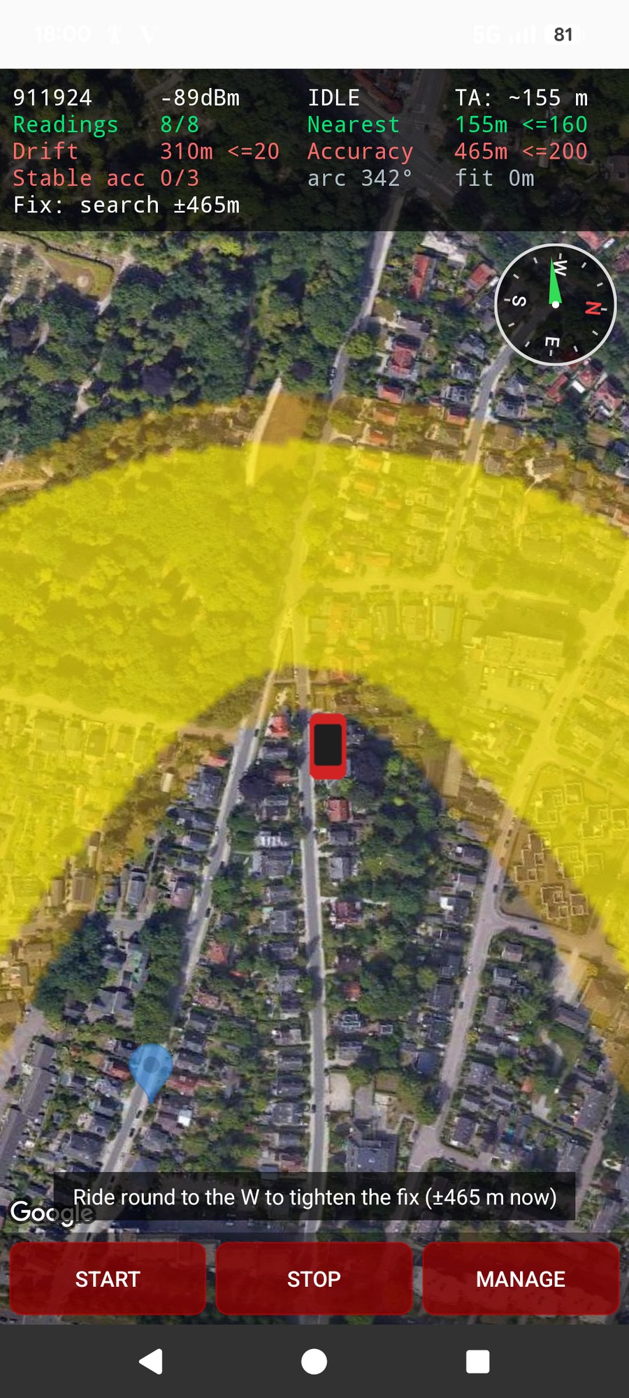
After a short walk the Readings target is already satisfied (8/8, green). Yet Accuracy is a hopeless ±465 m, Drift is huge and arc is still 342°, because every reading so far has seen the tower from roughly the same side. The rings all overlap along one arc, so the estimate can slide anywhere along it. This is the moment that matters.
Readings 8/8 TA ~155 m Drift 310 m Accuracy ±465 m arc 342°
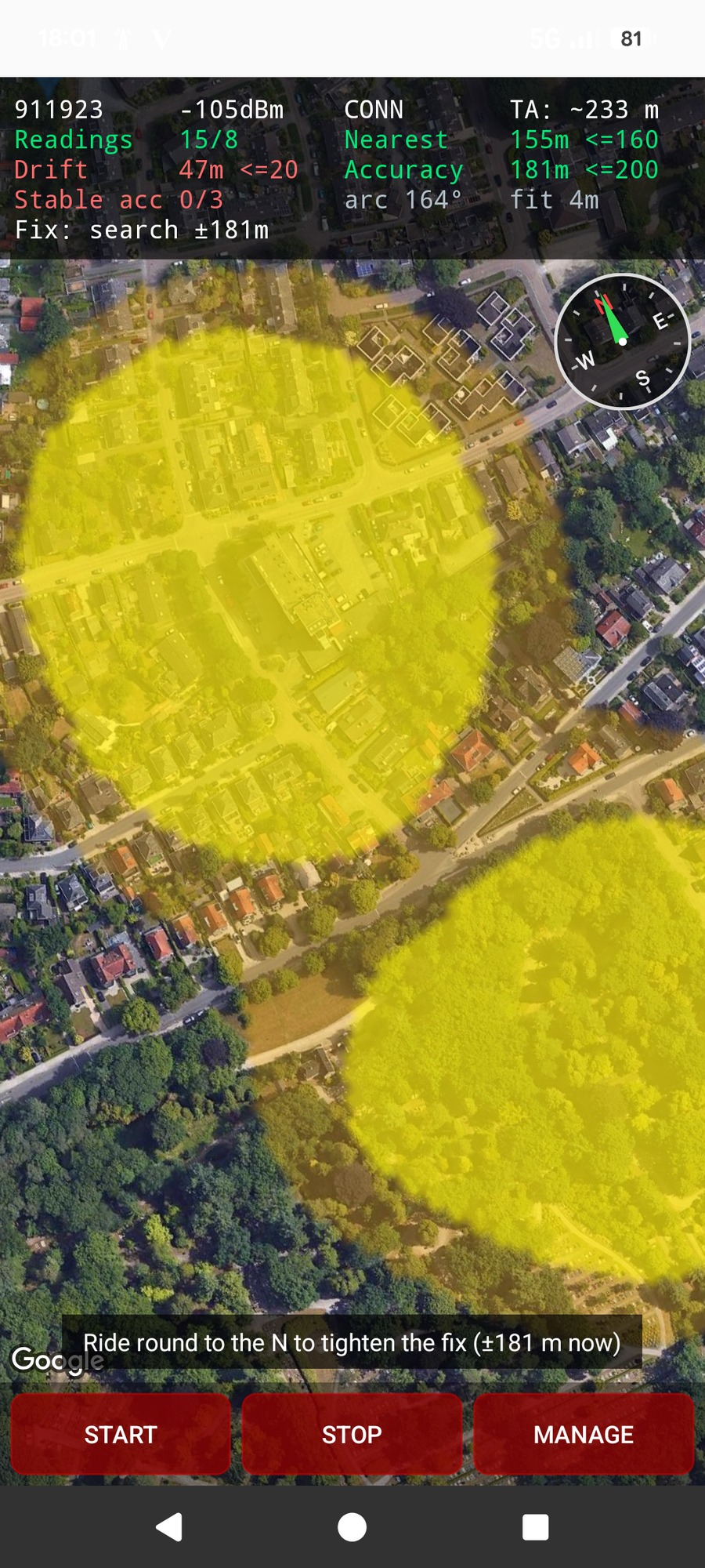
By riding round to a new side, the observed arc collapses from 342° to 164°: the rings now cross from two directions instead of one. Accuracy immediately drops under target to ±181 m, Drift is falling, and the low fit (4 m) shows the readings are consistent, i.e. good line-of-sight. CNA even prompts which way to ride next ("ride round to the N").
Readings 15/8 Accuracy ±181 m arc 164° fit 4 m Fix: search ±181 m
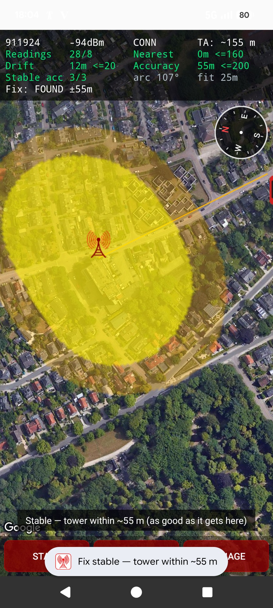
Finally the route passes right by the tower: Nearest reaches 0 m and TA bottoms out. With the arc down to 107° and the accuracy holding steady for three readings (Stable 3/3), the fix latches all the way to FOUND ±55 m. The yellow region has shrunk from the whole neighbourhood to a tight blob right on the tower marker.
Readings 28/8 Nearest 0 m Drift 12 m Accuracy ±55 m Stable 3/3 Fix: FOUND ±55 m
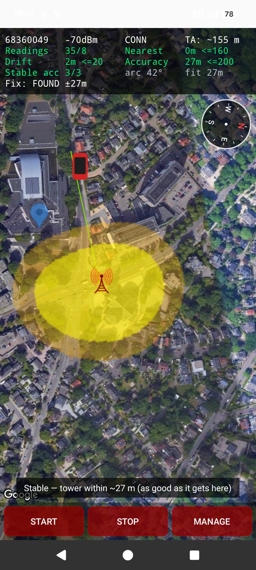
A second hunt on a different tower shows what happens when you circle well and pass close. Here the observed arc came all the way down to 42°, the tower was seen from many sides, and the route passed right by it (Nearest 0 m) with a strong −70 dBm signal. The result is a noticeably tighter FOUND ±27 m.
The lesson from both hunts: readings come for free, but accuracy is earned by geometry. Get closer (watch TA fall) and come at the tower from as many sides as you can.
Readings 35/8 Nearest 0 m Drift 2 m arc 42° Fix: FOUND ±27 m
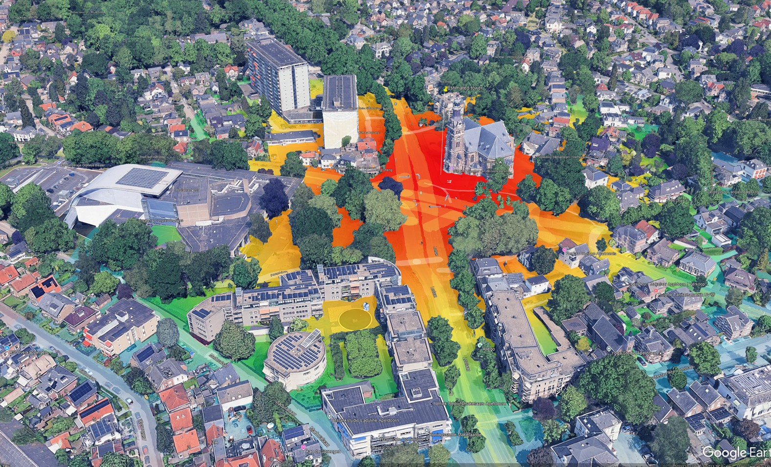
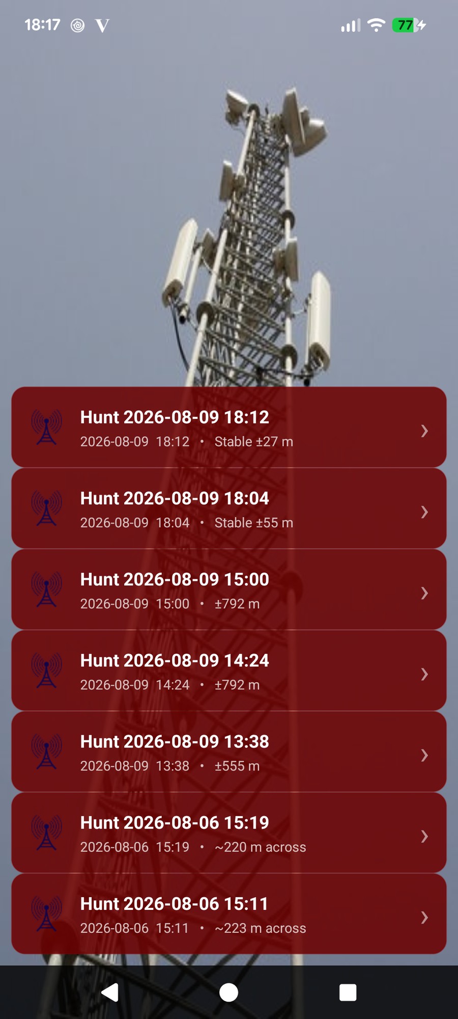
When you stop, a hunt is saved to a list (up to 10), each labelled with its final quality, for example Stable ±27 m. Open one to show its snapshot, rename it, or export it: a PNG of the result, the CSV of every reading, or the TA heatmap KMZ, the colour-graded cost surface shown at the top of this page, which explains exactly how the estimate was reached.
On stopping, CNA also offers to keep the estimate as a reusable tower reference, after comparing it fairly against any location already stored and only keeping it if it clears the quality bar.
The hunt CSV is a lean record of the convergence itself: one row per ingested reading, so you can replay how the fix tightened. Unlike the logging exports it is comma-separated. Every column is one of the readout parameters explained above:
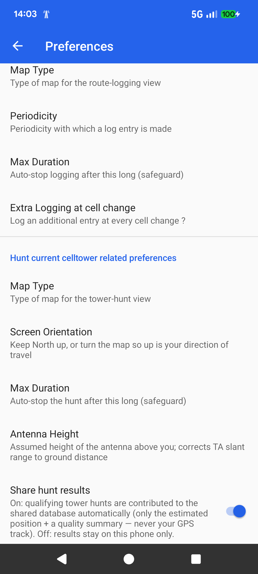
CNA can automatically contribute a good hunt to a shared tower database, so that everyone's lookups get better over time. The more people who hunt, the more accurate tower locations become for all users. To keep that database clean, a hunt is only eligible to be uploaded when it genuinely qualifies:
Only the estimated tower position and a small quality summary are ever sent, never your GPS track or route.
Along with the coverage map and route logging. Try everything with a one-month free trial.
✨ See Free vs Pro