Overview · CNA Pro
📍
Pro tool

Route Logging

Record a full drive test, every position, every tower, every hand-over, and replay it on a map or in Google Earth.
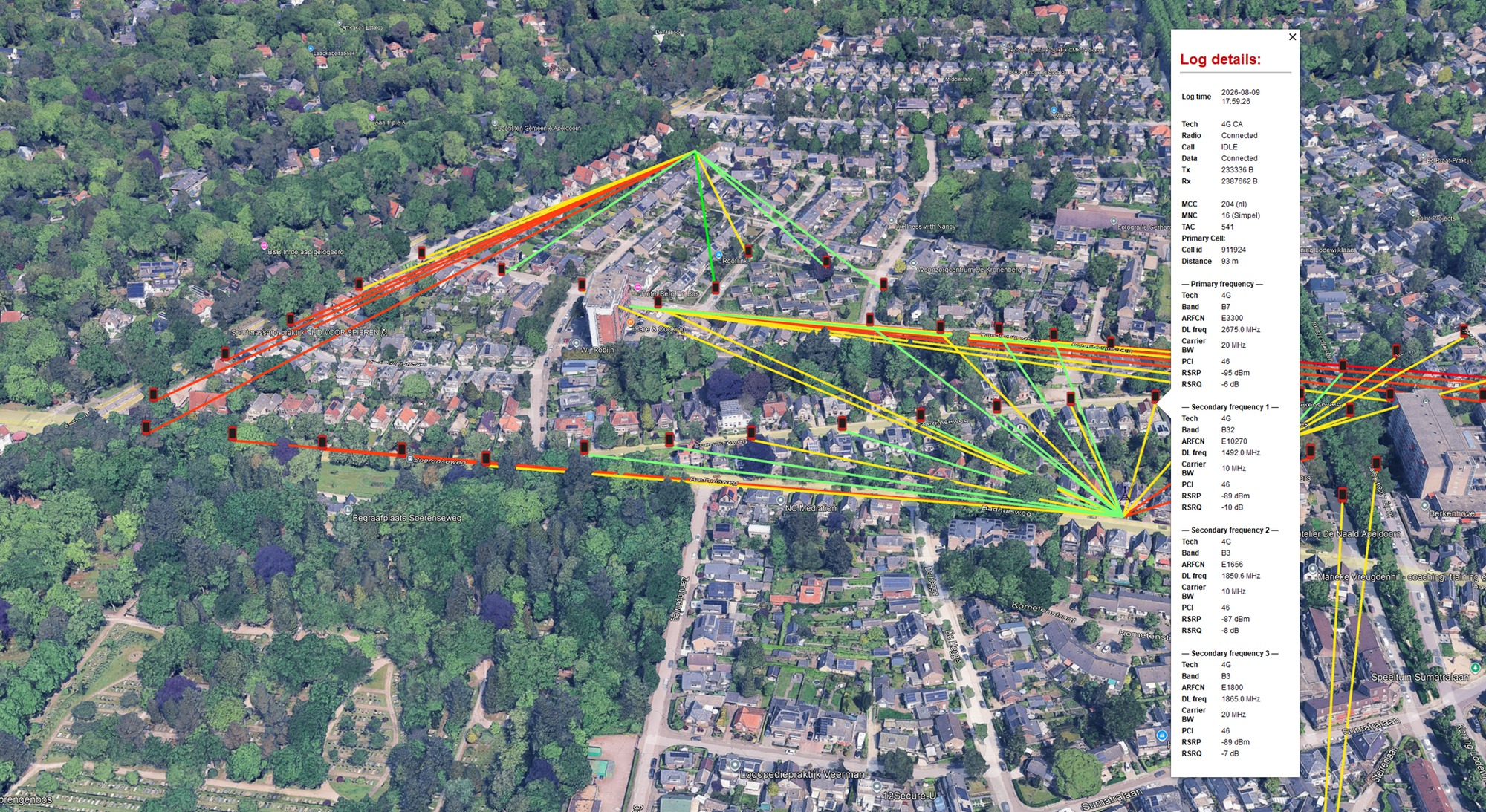
A route log in Google Earth

Start it and go

Press START and put the phone in your pocket. CNA records your position and the full tower connection at the interval you configured, and resolves each tower's location so you can see the whole picture (positions, towers, and the coloured links between them) even while the log is still running. STOP ends it (also possible from the notification), and MANAGE opens your saved logs.

Like the other tools it runs as a background service and can log in parallel with a coverage map and a tower hunt.
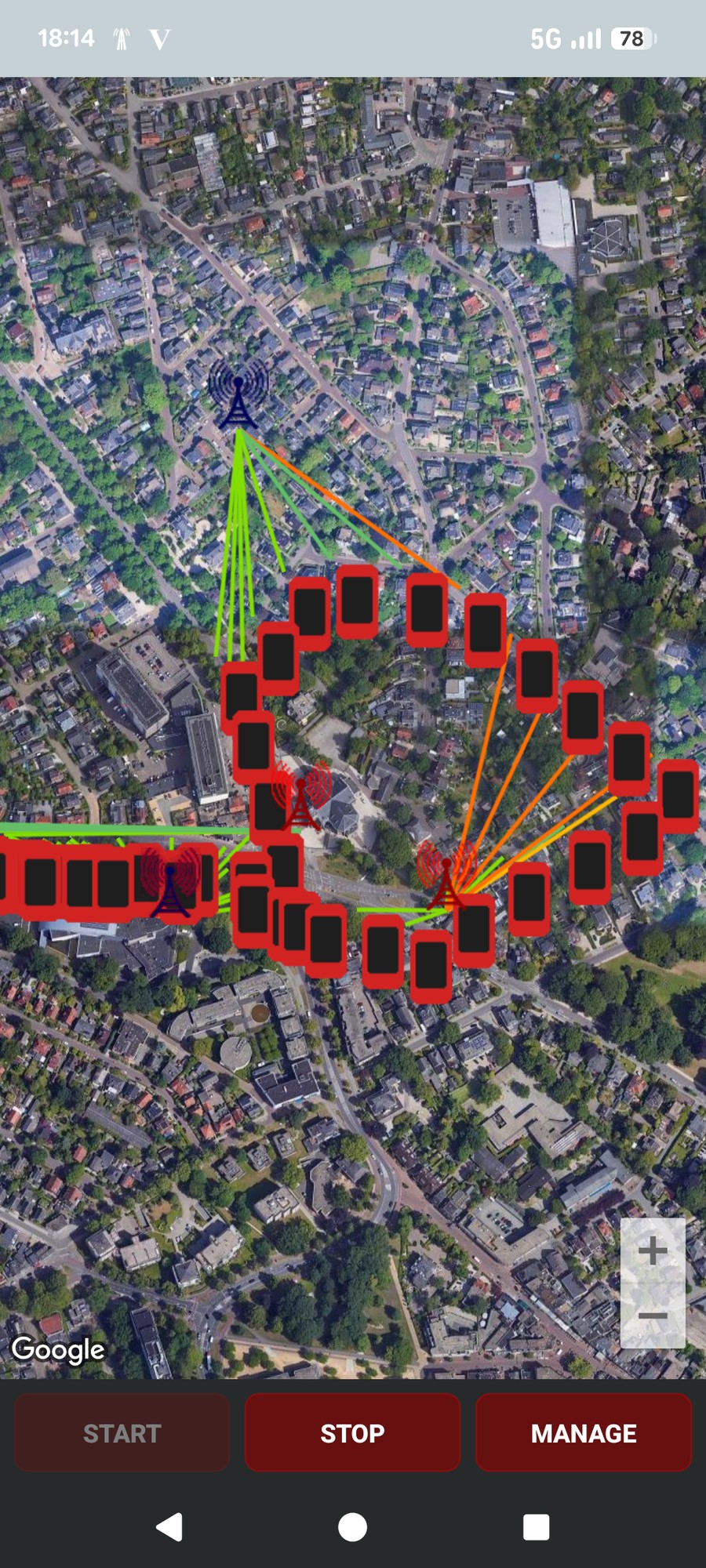
Live route log: phone positions and towers linked by signal-coloured lines
A route log in progress. Phone positions fan out to the towers that served them.
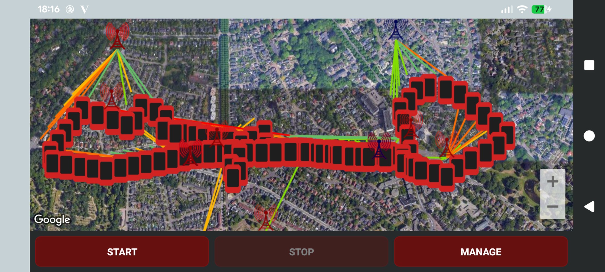
A longer route logged live, held in landscape, showing many positions and several towers
A longer route, live in the app: dozens of positions and several towers at once, each link coloured by the signal at that moment.

Two kinds of marker

Tap a phone position for a full network snapshot; tap a tower for a focused summary of that cell.
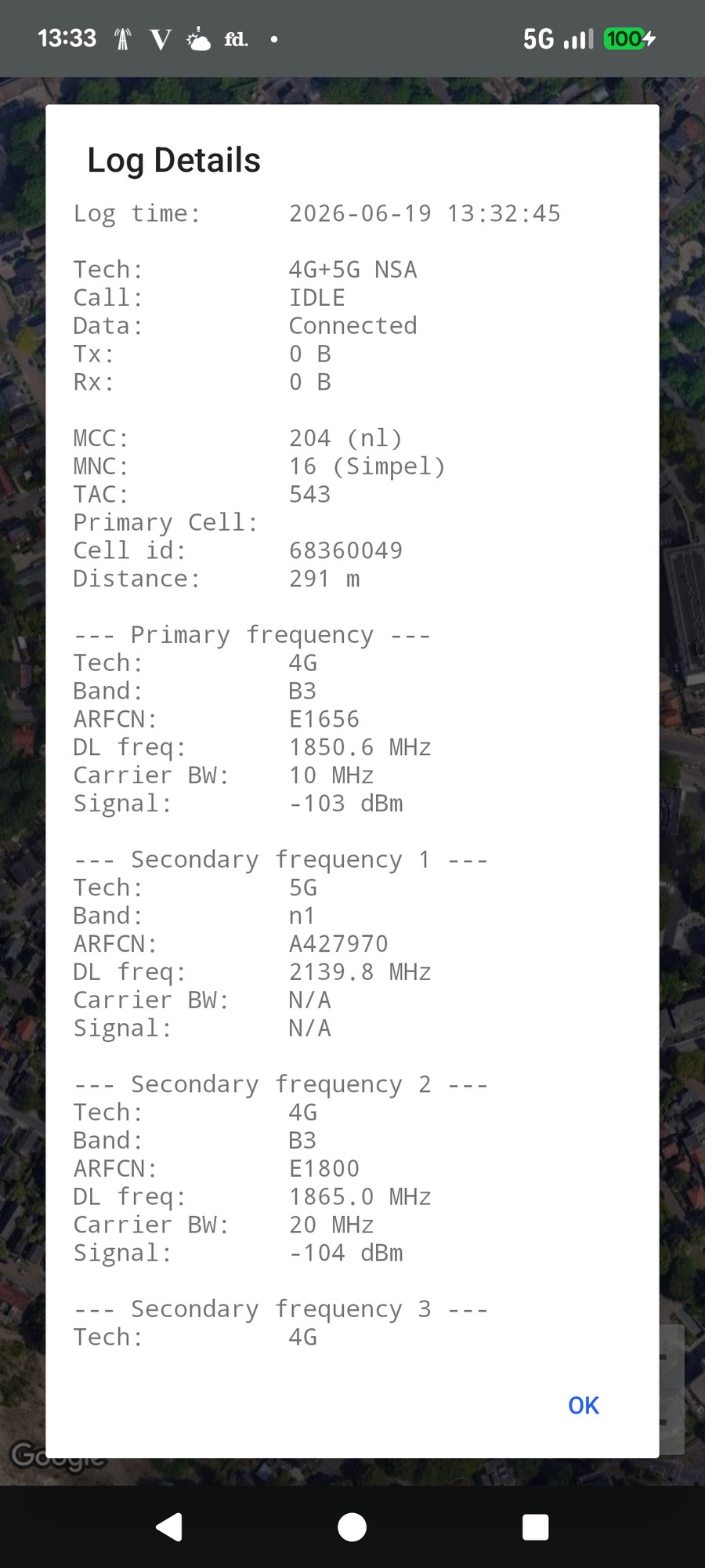
Tapping a phone position shows a full network snapshot
Tap a position (the phone). The full snapshot: tech, cell identity, distance, and the primary plus every secondary carrier (band, (E)ARFCN, frequency, bandwidth, RSRP and RSRQ).
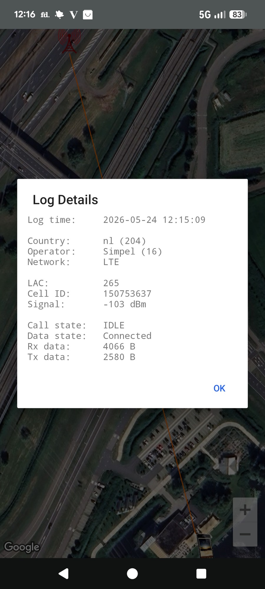
Tapping a tower shows a focused set of details
Tap a tower. A focused set of details for that cell: time, operator, network, LAC, cell ID, signal and data state.

Signal and tower colours

The line from each position to its tower is coloured by signal strength, so following the chain along a route shows at a glance where reception was excellent and where it dropped. Tower markers are coloured by network technology.
Signal strength (link colour)

≤ −110 dBm, very weak ≤ −100 dBm, weak ≤ −90 dBm, fair ≤ −80 dBm, good > −80 dBm, strong

Tower technology (marker colour)

GSM (GPRS/EDGE) UMTS / HSPA, 3G LTE, 4G 5G NR Other / unknown
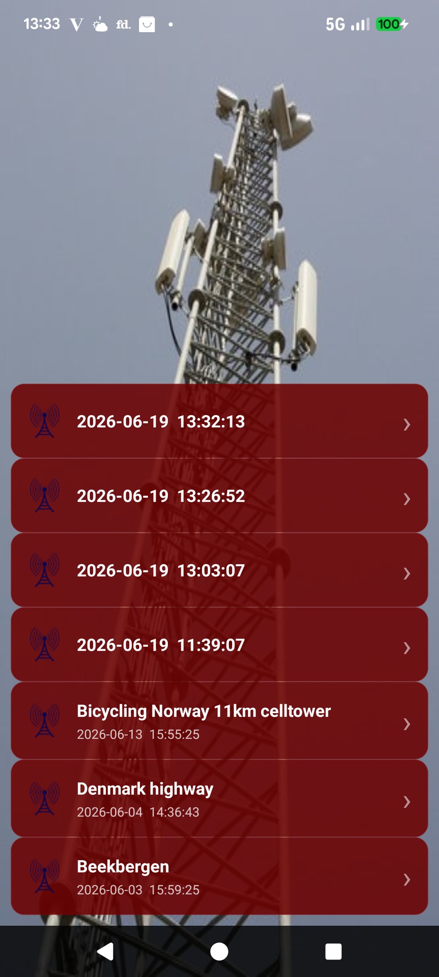
List of stored route logs
Your stored route logs (up to 10).

Manage your logs

Finished logs are saved to a list (up to 10). Select one to:
  • Show on Map, resolves any missing tower locations and shows the complete log; tap any marker for detail.
  • Rename, give it a meaningful name.
  • Upload KMZ, a Google Earth overlay like the one at the top of this page.
  • Upload CSV, the raw log for a spreadsheet.
  • Delete, once exported or no longer needed.
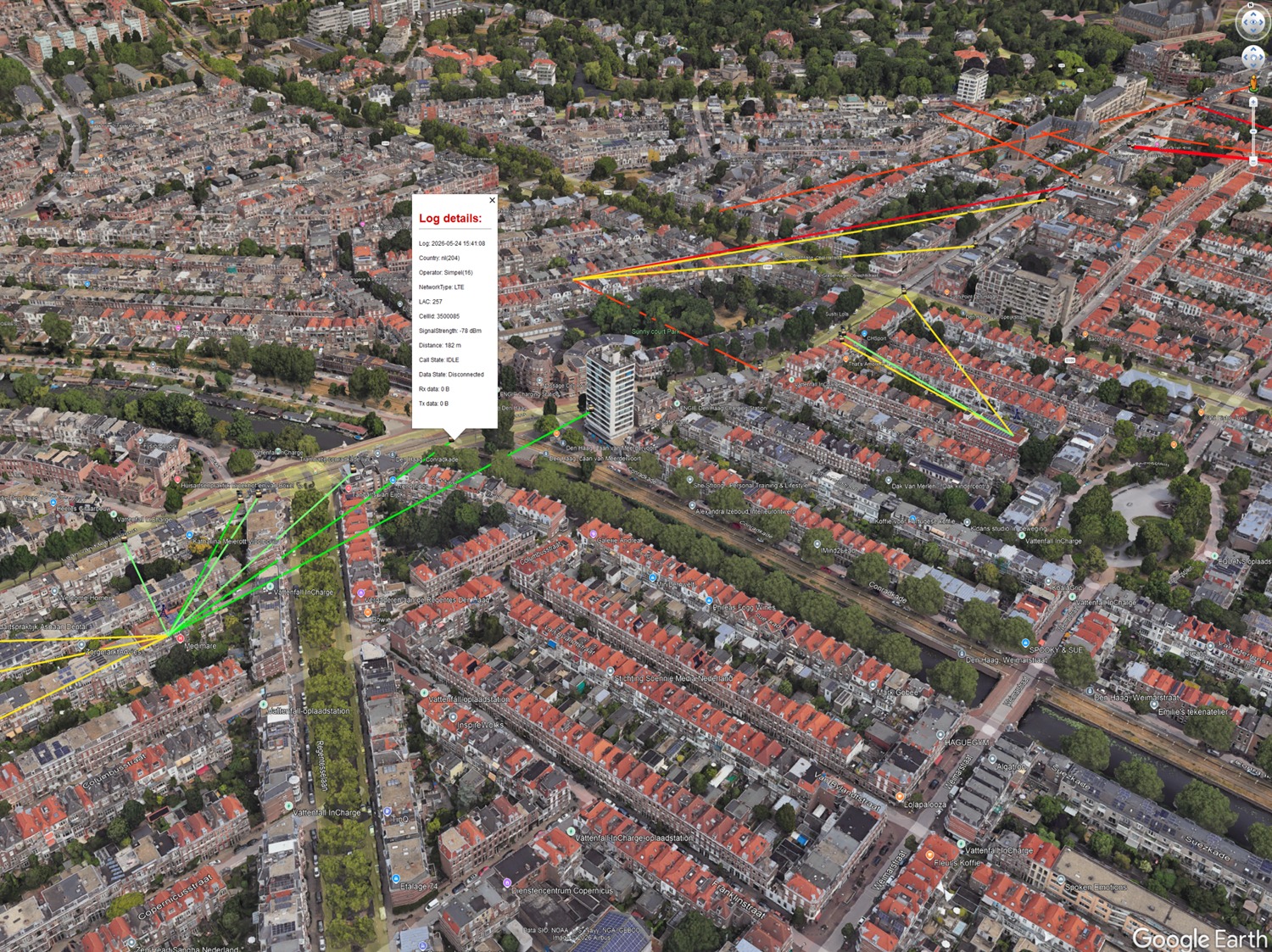
A second route-log KMZ example in Google Earth
Following the coloured links along a route shows, at a glance, where reception was strong (green) and where it fell away (orange and red).

What the CSV contains

The CSV is one row per log entry, ready for filtering, averaging and charting in a spreadsheet. It uses a semicolon delimiter (not a comma), so select that when opening it. Alongside the connection state and your position, it records the resolved tower position and its accuracy, then lays out the primary carrier and up to four secondary carriers, each with the same eight fields:

Then, for the primary and each secondary carrier:
💡 Gmail is recommended for emailing exports; some mail apps do not handle attachments correctly.

Applicable preferences

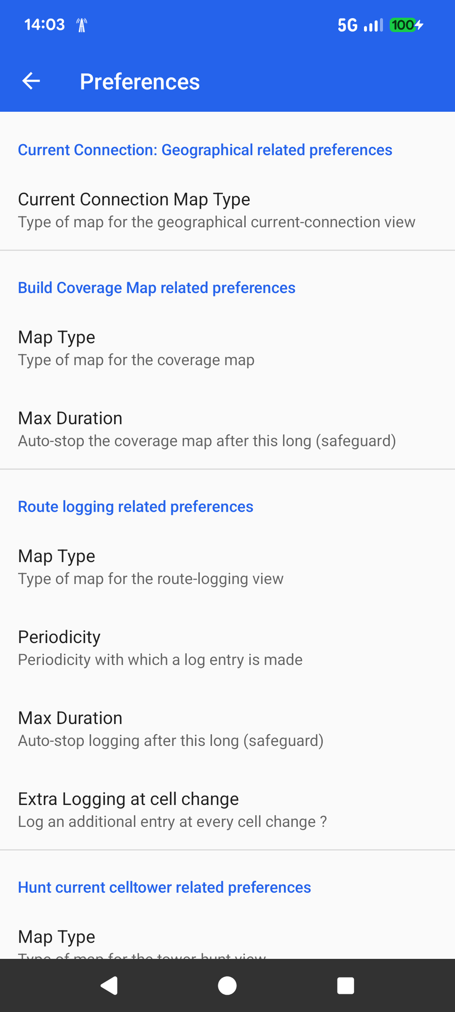
Preferences: Route logging settings
Preferences, Route logging.

Under Route logging related preferences:

  • Map Type, Street or Satellite for the log view.
  • Periodicity, how often an entry is stored (for example every 20 seconds).
  • Max Duration, a safeguard that auto-stops logging after the chosen time.
  • Extra Logging at cell change, records an additional entry whenever your phone switches cell, so no hand-over is missed on fast routes.

Next: hunt the tower itself

Route logging shows which tower served you. The Tower Hunt goes one step further and pins down exactly where that tower stands, to within tens of metres.

🔍 Open the Tower Hunt guide